


WARNING as strong winds and heavy rain set to batter Devon
Police are advising people to take extra care on Monday 8 February after the Met Office issued an amber weather warning of very strong winds.
Heavy rain and strong winds with gusts of between 60 and 70 mph are likely from 3am on Monday morning.
As a result, traffic disruption is expected due to fallen trees and flooded roads.
Motorists are asked to drive carefully, allow extra time for their journeys and avoid all flooded areas.
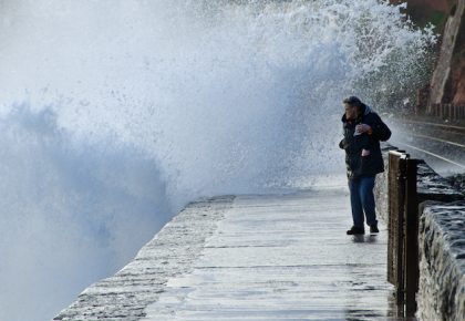
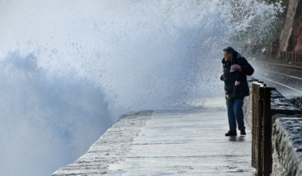
Members of the public are warned to stay away from coastal areas due to large waves, and asked to check outdoor bins and other items in the garden are secure.
Up to date information on traffic and travel disruption can be found on the police website (traffic watch) as well as Highways, National Rail and other sources’ websites and social media accounts.
Environment Agency flood warnings are available at https://flood-warning-information.service.gov.uk
Tonight and into Monday storm force winds are expected to lead to overtopping waves and spray for the Devon and Cornwall coasts.
Jonathan Day, Environment Agency Duty Flood Risk Manager said: “Storm Imogen will lead to large waves and spray along the south and south-west coastal parts of England on Sunday night and Monday.
"We understand it is tempting to see the force of Mother Nature but people should take extreme care on coastal paths and not put themselves and rescue workers at risk. Please listen to the advice of the coastguard and the police about safe places to be.
"Flooding of low lying coastal roads is also possible and people should also avoid driving through flood water.
“There is also continued risk of minor river flooding into next week in the south and south west of England as rivers will continue to rise in response to recent rainfall Environment Agency teams, as always, are out on the ground monitoring the situation and will issue flood warnings and alerts as required. The public can keep up to date with the latest situation on GOV.UK or follow @EnvAgency and #floodaware on Twitter for the latest updates.
The Met Office forecast is as follows:
Tonight:
Windy with gales and severe gales after midnight, especially over exposed coasts and hills. Rain clearing to scattered heavy showers, these merging into longer spells of rain at times. Minimum Temperature 5°C.
Monday:
Gales and severe gales with gusts of 70-80mph slowly easing later in the afternoon. Scattered, locally heavy, showers will gradually become less frequent through the afternoon too. Maximum Temperature 9°C.
Outlook for Tuesday to Thursday:
Tuesday will have further showers but less widespread than on Monday. A frosty start then light winds, dry with sunny spells for many on Wednesday. Wet and windy for Thursday.